
Finding Bethlehem Township Residents
Bethlehem Township has no single public roll that lists every person at every address. Start with the strongest fact already in hand. A current street address points first to Northampton County property data, while a recorded party name belongs in the deed index. An individual voter question belongs with the state status tool, and a court question needs a case number or careful party-name match. Each Bethlehem Township result should be checked for county, municipality, date, and the field that produced it before it is treated as a useful lead.
The practical sequence is short but deliberate. Property information can anchor a parcel, the Recorder can identify a recorded transfer, and library or archives material can put an older address in context. Bethlehem Township municipal files are a separate layer for permits, inspections, zoning, and Right-to-Know requests. They do not replace Northampton County land records. A missing result can reflect a different custodian, a protected record, an old number, or a record type that was never put online.
- Use the county property search with an address, parcel, or owner when a Bethlehem Township property is involved.
- Confirm map, block, lot, location, and deed reference in the county GIS tools.
- Use the Recorder’s index or counter path for the recorded document and its prior reference.
- Verify one eligible voter through the state’s individual registration-status route, not as a street list.
- Use BAPL, County Archives, or a focused RTKL request when the needed record is not online.
Note: A parcel owner, a deed party, and a current resident are different record roles that may overlap but should not be assumed identical.
Bethlehem Township Records Desks
Bethlehem Township sits wholly in Northampton County, so the county is the main custodian for assessment data, recorded land instruments, elections, courts, probate, and archives. The Township is not the City of Bethlehem. Use Township channels for local permit, zoning, meeting, police-record, and RTKL matters, then use the county office that actually keeps the underlying record. The following desks give a Bethlehem Township search a clear place to start without blurring county and municipal custody.
Northampton County Recorder of Deeds
669 Washington Street, Room L116
Easton, PA 18042-7486
610-829-6210
Northampton County Assessment Office
669 Washington Street
Easton, PA 18042
County property-data access
Northampton County Election Division
County Government Center, lower level
669 Washington Street, Easton, PA 18042
Weekdays, 8:30 a.m. to 4:30 p.m.
Bethlehem Township RTKL Office
4225 Easton Avenue
Bethlehem, PA 18020
610-814-6400
Recorder documents are imaged, sent to retrieval stations, microfilmed, and publicly inspectable. Assessment fields are current administrative data. Election and court records have their own access rules, and a Township request should describe a record class, date range, address, parcel, or case identifier rather than ask for a broad dossier.
Bethlehem Township Parcel Starting Point
For an address-based Bethlehem Township search, the Northampton County property system is the useful first screen. Its navigation shows Address, Parcel, Sales, Advanced, and Map Search modes. The county labels its data read access and says accuracy and currency are not guaranteed, so treat the result as an assessment-side record and a bridge to another custodian. Record the parcel identifier, location, map, block, lot, sale data, and deed reference before moving on.
A property profile can show owners, a care-of line, mailing city/state/ZIP, land-use information, values, homestead or farmstead flags, tax information, photos, sketches, and map links. Those fields help distinguish a taxable parcel from a person record. A homestead indicator is an assessment-program field, not proof that every person at a Bethlehem Township address lives there now. The street-level chain is detailed on the Bethlehem Township street directory.
A current screenshot of the Northampton County Public Access property records shows the official starting point for Bethlehem Township residents directory parcel work.
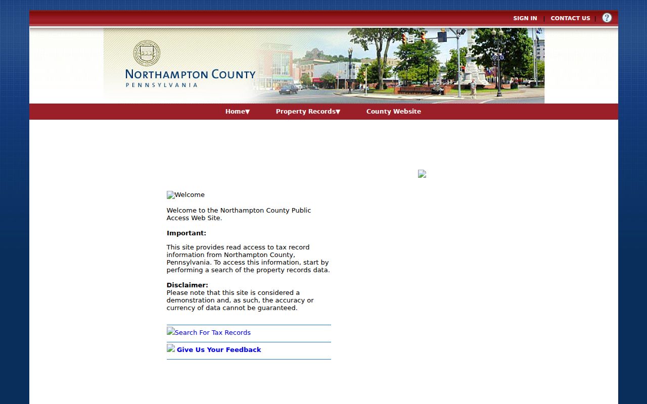
Use the property screen to collect a parcel reference, then verify any recorded transfer through the Recorder rather than relying on the assessment display alone.
Bethlehem Township GIS Field Meanings
The county’s Assessment and Land Records GIS service exposes Parcels, Parcel Lines, Address Points, and Lot Dimensions. Its parcel schema includes Parcel ID, CAMA ID, Map, Block, Lot, municipality code, acreage, Location, deed reference, owner lines, and three mailing-address lines. It also includes values, sale date and price, year built, and program flags. That fuller field list makes a Bethlehem Township address trail more precise than a name-only search.
LOCATION is the situs, or physical taxable parcel location. MAIL_ADDRESS_1–3 is the tax correspondence destination. OWNER LINE 1–2 identifies the assessment owner. A mailing address may match the situs, but it may also differ. None of these fields is a complete household roster. The county service also supports parcel geometry and links the assessment record to a deed reference, which helps a Bethlehem Township researcher select the next record instead of drawing a conclusion from one field.
| County field | Use in a Bethlehem Township search |
|---|---|
| LOCATION | Physical situs for the taxable parcel |
| MAIL_ADDRESS_1–3 | Tax correspondence, which may differ from situs |
| Map / Block / Lot | Land-reference components for map and deed work |
| DEED | Bridge to the Recorder’s instrument or prior-reference trail |
| SALE_DATE / SALE_PRICE | Assessment-side sale context, not a complete ownership chain |
The county GIS land-record service is pictured below with its Bethlehem Township residents directory parcel layers.
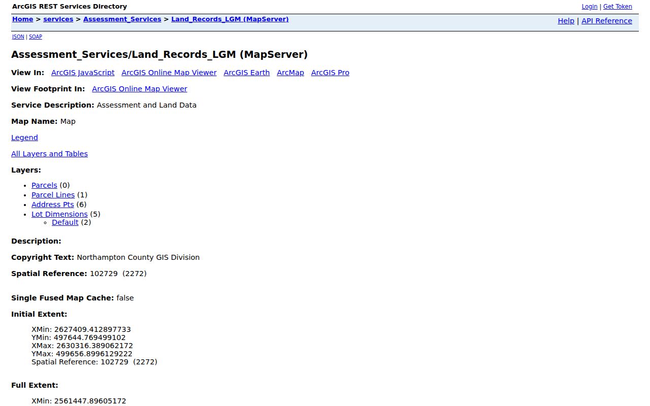
Parcel lines and address points add map context, but an online map is not a legal survey and its measuring tool does not set a boundary.
Northampton Landex Deed Routes
Recorded deeds, mortgages, plans, easements, and related instruments create a documented party trail for a Bethlehem Township parcel. The LANDEX Document Publishing Search offers General, Instrument Number, and Book and Page modes. General search requires at least one county and document type. It has Company/Last Name, First Name, Begin Date, End Date, document-type boxes, and a search button. A person search needs a First Name value, while a company search leaves it blank.
| LANDEX control | Format or limit | Best Bethlehem Township use |
|---|---|---|
| General county search | County and document type required | Find a party or a type of recorded instrument |
| Company/Last Name and First Name | Text; use * for all matching a surname | Narrow a recorded party name |
| Begin and End Date | MM/DD/YYYY | Reduce broad name matches |
| Document type | Deed, mortgage, satisfaction, will, or other | Limit the transaction class |
| Instrument Number | Exact required number | Retrieve one known instrument |
| Book and Page | Exact required numbers | Follow a prior deed reference |
LANDEX documents ? and * wildcards, but its name results cap at 250 matches. Add a date or document type when a surname is common. Exact instrument and book/page routes do not use wildcards. The form does not publish a Northampton-specific online start year, so a web result should not be described as the whole historical chain.
The LANDEX search interface provides the three official query routes used in this Bethlehem Township residents directory record trail.
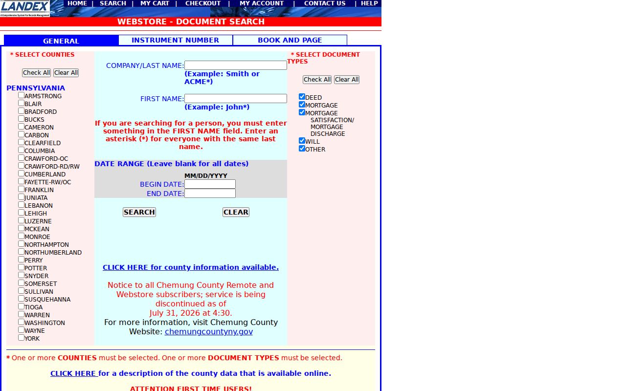
When the parcel profile or a current deed supplies an exact reference, book and page or instrument number is usually more reliable than an open-ended party search.
Bethlehem Township Deed Fallbacks
Northampton County keeps a stronger counter fallback than an online search alone suggests. The County Archives available-records page says Landex is available at both the Recorder and Archives. The Recorder states that recorded instruments are microfilmed and publicly inspectable. BAPL’s house-research guide describes starting with the current parcel and deed, using the Recorder computer, then following a preceding book/page through deed books and microfilm when the computer no longer recognizes the reference.
That sequence matters for Bethlehem Township houses with older deeds or changing numbers. Capture the current parcel ID and deed reference, retrieve the current instrument, read its prior-reference language, and work backward by instrument or book/page. The grantor is the person transferring an interest; the grantee is the person receiving it. Those named roles identify a transaction, not who occupied the property between transfers. County Archives also lists individual tax assessments from the late 1700s through 1882 as a historical path.
- Parcel
- A defined taxable land unit in the county assessment and GIS systems.
- Index
- A finding tool that points to a record; it is not always the record image itself.
- Grantor / grantee
- The parties transferring and receiving an interest in a recorded instrument.
- Criss-cross directory
- A dated directory arranged by street or address when a selected edition includes that feature.
Note: County Archives offers free in-person research, while remote name research and copy charges should be confirmed with Archives before a request is made.
Bethlehem Township Voter Boundaries
The Pennsylvania Check My Registration Status route verifies an individual’s registration and polling information. It is not a browse-by-street roster. The state page was not available for a stable field capture during the research, so no name-only capability should be assumed. A Bethlehem Township voter query should be limited to the individual verification the state permits, and a nonmatch should not be treated as proof that a person left the Township.
The fuller voter file follows a controlled request and permitted-use process under Pennsylvania election law. Registration-commission records, district registers, street lists, and related materials have inspection and use rules. Protected-address participants are suppressed. The state’s SURE export is an election-data request product, not a casual resident directory, and voter participation means an election was participated in, never a ballot choice. Northampton County’s 2026 redistricting notice is also a reminder that polling-place and district information can change without a move.
Bethlehem Township Court Match Checks
A court docket can confirm a publicly available case role, court, docket number, event, or disposition. It cannot make a same-name hit into an identity match. Use UJS Case Search with a full legal name and narrow by Northampton County, filing date, court, party role, middle initial, or a known address when the portal permits it. Then read the docket sheet and its identifiers. Bethlehem Township cases may appear in a Magisterial District Court or Northampton County Court of Common Pleas context.
UJS allows routes such as participant name, docket number, date filed, complaint number, citation number, incident number, organization, and parcel. The Participant Name route has last and first name fields, an optional date of birth, optional county and court filters, and docket-type/status narrowing. Sealed, expunged, juvenile, adoption, and other protected material is not a public search target. For a civil filing, the Northampton CountySuite Civil search is the county’s additional civil channel.
Bethlehem Township Permit Records
Bethlehem Township Community Development files can add a dated address trail when a property has a building, zoning, certificate-of-occupancy, or inspection record. The current building/zoning form asks for a job-site address, parcel ID where applicable, owner mailing address, work description, setbacks, plans, and other project details. That makes a permit useful for tracing a proposal or municipal process. It is not a complete resident list and an application does not prove completion or occupancy.
The Bethlehem Township SmartGov portal lets account users view their applications and inspection results, request information, and reach reports/documents. Research did not find an anonymous name or address permit search on its public screen. For a record not shown to the account holder, use the Community Development counter or a narrow written Township RTKL request with an address, parcel, date range, and specific record type. Redactions and statutory response rules still apply.
The official SmartGov public portal is shown here as a Bethlehem Township residents directory municipal-records access channel.
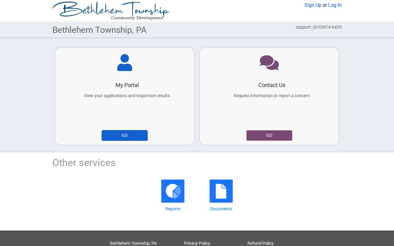
Account-based access is valuable for an applicant’s own records, while a properly described RTKL request is the documented public fallback for non-exempt Township records.
Current Bethlehem Township Directories
A current Bethlehem Township residents directory is assembled from different official sources, each with a narrow meaning. The county property roll identifies assessment owners and parcel fields. The Recorder identifies parties to recorded instruments. The state voter route verifies an individual’s election registration context. Township permits may document an application or inspection process by address. None of those sources supplies every renter, household member, utility customer, or protected participant, so each row below should be read as a separate record trail.
| Current source | What it can show | Custodian | Access boundary |
|---|---|---|---|
| Property and GIS roll | Parcel, owner, situs, mailing, sale, deed reference | Northampton Assessment and GIS | Free read access with county data disclaimer |
| Recorded-instrument index | Named deed, mortgage, plan, or easement parties | Northampton Recorder | LANDEX, counter, Archives, books, and microfilm paths |
| Voter-status route | Individual registration and polling context | Pennsylvania and County Elections | Not a public street browse; protected voters suppressed |
| Township permit files | Address, parcel, applicant/owner representation, work process | Bethlehem Township | SmartGov account, counter, or RTKL request |
| BAPL historical materials | Dated directory, map, newspaper, obituary, and house clues | Bethlehem Area Public Library | Coverage varies; Bethlehem Room material is non-circulating |
For one person, compare at least two independent records that answer the same narrow question. The value is in the match among a date, parcel, instrument, court case, or directory edition, not in expanding a partial result into a general claim about a Bethlehem Township household.
Bethlehem Township Records Compared
Official records have an identified custodian, a stated scope, and a correction route. They can still be incomplete, dated, redacted, or wrong. Unverified compiled listings can combine old or mismatched data and do not replace the county or state source. For a Bethlehem Township residents directory search, the most useful comparison is not free versus paid. It is whether a record actually answers the question and whether its keeper can confirm it.
| Official custodian record | Unverified compiled listing |
|---|---|
| Names the office that maintains the parcel, instrument, docket, or voter record | May not identify the original record or update date |
| Shows a defined record role, such as owner, party, or applicant | May collapse distinct people or roles into one profile |
| Provides a correction, counter, or request channel | Cannot override the custodian’s lawful retention of a public record |
| Has access and redaction rules that can be checked | Should be treated as a lead requiring independent verification |
Bethlehem Township Historical Directories
Past Bethlehem Township households are usually a Greater Bethlehem library and archives question, not a complete Township-only directory run. The Bethlehem Room holds non-circulating directories, maps, clippings, newspapers, obituaries, and a house-research guide. BAPL verifies directory material from 1900/1901 onward, including selected 1900–01, 1904, 1906, 1911, and 1917–18 volumes. It does not support a claim of uninterrupted Township coverage.
One dated entry can connect a name, address, occupation or business context, nearby entries, and a source page. It cannot establish a current address. The historical shelf works best after the county parcel and Recorder trail supplies a street, legal description, or period to test. House numbers can change across decades, so record neighbors and cross streets with the selected edition. The fuller historical collection treatment belongs on the Bethlehem Township city directory page.
Bethlehem Township Boundary History
Record geography is especially important here. Bethlehem Township was formed from Bucks County territory in 1746 and originally included land that later became parts of Upper and Lower Nazareth Townships, Bethlehem, and Freemansburg. Separations occurred in 1780, 1807, 1845, and 1856. A historical reference to Bethlehem Township can therefore point to a different present municipality. Start with the county, the period, and the place name as used in the record before choosing a modern office.
The Township’s recorded history runs from older farms and mill areas to later development, but the custodian path remains clear: current parcel and deed work is Northampton County; Township permits and zoning stay municipal; older directories and maps often sit with BAPL or archives. The Township’s status as a first-class township does not make it a branch of the City of Bethlehem.
Bethlehem Township Record Alert
Northampton County’s free Record Alert is a practical records-safety tool for a Bethlehem Township name or parcel. It monitors verified recorded documents against exact registered names or parcel/UPI numbers. A single email-and-phone combination can monitor up to five names and five parcel/UPI numbers. Name variants should match legal papers, suffixes belong in the first-name field, and punctuation is omitted under the service instructions.
An alert reports the registered name, recording date, instrument number, instrument type, and municipality. It can send email or text notice. It is not title insurance, proof of an ownership change, or a decision about legal title. A common name can produce an unrelated notice, so use the official Recorder index and the document reference to verify any alert before acting on it.
The Northampton County Recorder page documents the official land-record and monitoring context for this Bethlehem Township residents directory feature.
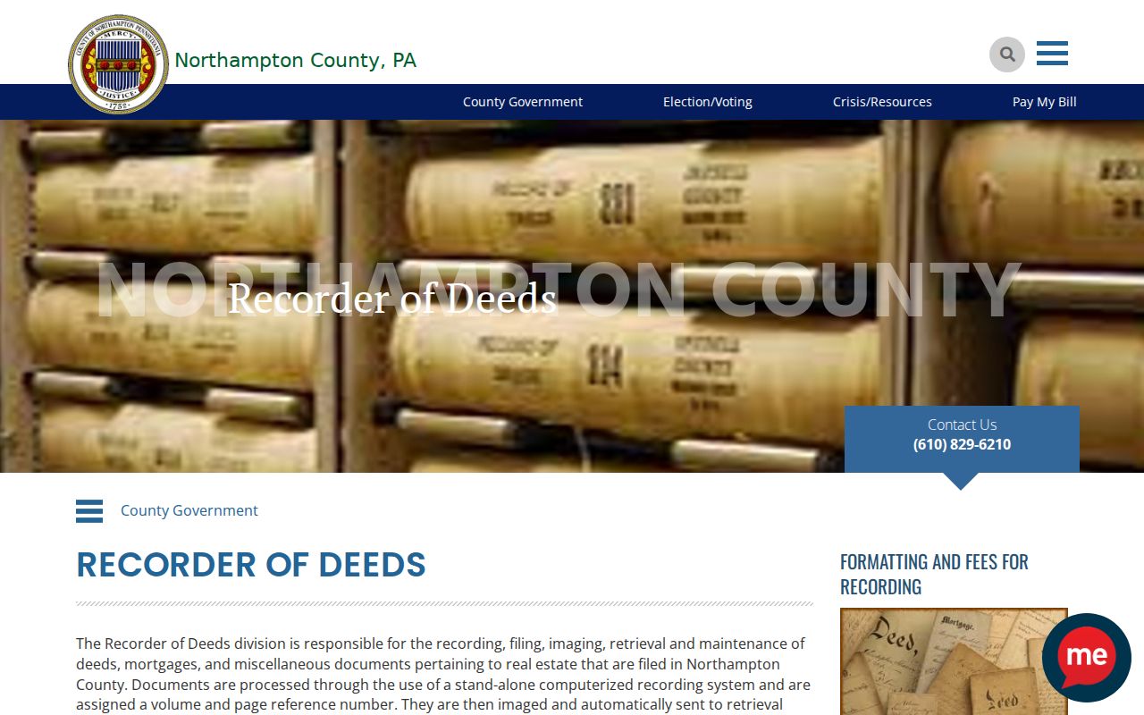
The Recorder remains the custodian to contact when an alert, index entry, or recorded-document copy needs confirmation.
The Northampton County Record Alert page shows the monitored-document service available for a verified Bethlehem Township name or parcel.
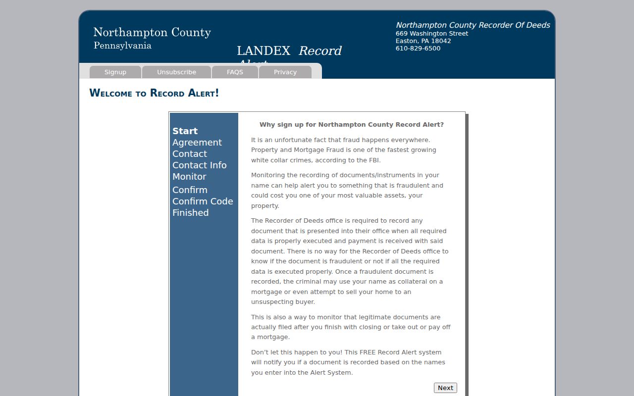
Use the alert as a notice to inspect the official instrument, not as a conclusion about title, residency, or a document's legal effect.
Bethlehem Township Privacy Limits
Pennsylvania’s Right-to-Know Law opens many agency records but also requires exemptions and redactions. The Office of Open Records Citizens’ Guide explains that a written request should identify records with enough specificity, and the agency may need legal review, retrieval time, or redaction. For Bethlehem Township municipal records, name the address, parcel, date interval, and particular permit or inspection file. Do not ask an office to create a broad person profile.
Some gaps are required protections. The Pennsylvania Address Confidentiality Program can provide a substitute address for eligible people. Driver and vehicle data are restricted, voter-file access is controlled, and courts protect sealed, expunged, juvenile, adoption, and other confidential material. Utility accounts and unlisted household members are not part of the public record trail. If a county, court, election, or Recorder field appears wrong, contact the agency that maintains it for the appropriate correction process.
Note: A suppressed or missing result can reflect a lawful protection, a different custodian, or an incomplete historic source rather than an absence from Bethlehem Township.