
Finding Bethlehem Township Neighbors
Official records describe parcels, documents, and public processes around a target address. They do not identify a block's entire household population. Start with the record that matches the question. The county map shows which parcels touch or sit beside a target. The assessment roll shows the recorded owner line, tax mailing lines, and parcel data. The Recorder identifies parties to a deed or plan. Township files can provide dated development context. Bethlehem Township neighbors should be understood through those separate records, with each result kept in its proper lane.
| Block source | Useful result | Access boundary |
|---|---|---|
| County parcel map | Target polygon, adjoining parcel lines, address points, and lot dimensions | Free county GIS service, not a legal survey |
| County property roll | Owner lines, situs, mailing fields, map/block/lot, values, sale and deed references | Current assessment data, not a household list |
| Recorder instruments | Recorded parties, plans, easements, transfer dates, and legal descriptions | Online entry, counter, LANDEX, and microfilm paths |
| Township files | Permit, zoning, inspection, or development context for a selected address | SmartGov account, office, or Right-to-Know request |
| BAPL maps and directories | Historical street context and dated nearby entries where a volume covers the street | Bethlehem Room or digital collections; coverage varies |
The useful distinction is between a recorded connection and physical presence. An owner line can show who the assessment system associates with a parcel. A situs is the taxed location. A mailing address is where tax correspondence goes. None establishes every current occupant, renter, guest, or family member. That restraint matters when comparing parcels around a Bethlehem Township address.
Bethlehem Township Parcel Layers
The Northampton County land-records service publishes Parcels, Parcel Lines, Address Points, and Lot Dimensions. Its parcel layer is joined to assessment information by CAMA ID. It also publishes fields for parcel and CAMA IDs, map, block, lot, municipality, acreage, location, owner lines, three mailing-address lines, deed reference, sale information, year built, and assessment-program flags. Those layers make it possible to examine the few parcels immediately around an address without treating a map as a social roster.
Begin at parcel scale. The county's Tax Parcel Viewer instructions document typed location and owner searches, map browsing, right-click information, a ruler, and PDF map printing. They do not document a neighbor button, a radius list, or a block-voter export. The reliable method is slower: select the target, then select each boundary-sharing polygon individually.
The county parcel-layer schema makes clear why field labels matter when looking for Bethlehem Township neighbors.
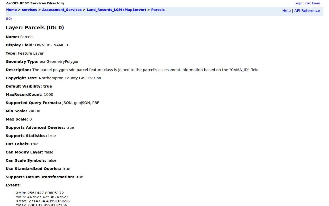
The published schema supports a parcel-based comparison while preserving the difference between an owner field and a statement of who lives nearby.
Reading Bethlehem Township Parcel Fields
Parcel data has several address-like fields that do not mean the same thing. The service labels the taxable place as LOCATION and uses MAIL_ADDRESS_1 through MAIL_ADDRESS_3 for correspondence. It has two owner lines as well. A correspondence address can match the parcel or be elsewhere. A homestead or farmstead flag is an assessment-program indicator. It is not proof that all people at an address are present residents. The county itself cautions that its public property data is read access and cannot guarantee accuracy or currency.
- Parcel
- A mapped unit of land in the assessment system, identified by a parcel or CAMA ID.
- Situs or location
- The physical taxable place shown in the county's
LOCATIONfield. - Mailing address
- The destination for assessment correspondence, which can differ from the situs.
- Deed reference
- The recorded instrument connection that helps move from a parcel record to the Recorder's document trail.
Note: A map result supports a carefully limited property-record finding, not a conclusion about all Bethlehem Township neighbors at the address.
Mapping a Bethlehem Township Block
Map a block as a short record trail, not a sweeping name search. The first goal is to establish the target parcel and the parcels that share a boundary. Preserve the parcel ID, map, block, lot, location, and deed reference for each selected polygon. If an ownership or boundary question matters, use those identifiers to reach the record custodian. The online ruler can estimate distance or frontage, but it cannot settle a property line.
- Search the target address or parcel in the county property system or Tax Parcel Viewer, then confirm the map location.
- Right-click the target parcel and each adjoining polygon. Record the parcel identifier, location, owner lines, mailing lines, map/block/lot, and deed reference separately.
- Open the property profile only to compare assessment-side information. Do not convert a mailing field or program flag into an occupancy claim.
- Use the deed reference or legal description at the Northampton County Recorder of Deeds to identify the recorded instrument behind a parcel.
- For a formal boundary, obtain the recorded plan or survey through the Recorder and seek qualified professional advice when needed.
That method stays focused on the immediate block. A question about a full named road needs the broader, parcel-by-parcel process in the Bethlehem Township street directory.
Bethlehem Township Deeds Beside You
When a selected parcel has a deed reference, the Recorder is the documentary next step. Its LANDEX Document Publishing Search has General, Instrument Number, and Book and Page modes. General search uses county selection, Company/Last Name, First Name, beginning and ending dates, document-type boxes, and a search button. Instrument and Book/Page modes are useful when a parcel profile or an earlier record provides a precise number. The name search can return no more than 250 matches, so date, document type, and exact references are valuable narrowing tools.
A deed can name the parties to a transfer and describe the land. It does not announce a current neighbor relationship. For older work, the county says recorded instruments are imaged, sent to retrieval stations, and microfilmed for inspection. LANDEX is available at both the Recorder and County Archives, and the local BAPL house-research guide explains the transition to deed books and microfilm when a computer no longer recognizes a book/page. That is the local fallback for a land trail, not a shortcut to a household list.
Bethlehem Township Public Block Contacts
No official Township-wide neighborhood-association directory or HOA membership directory was found in the reviewed municipal and county material. Instead, Bethlehem Township publishes public participation through its Board of Commissioners, Planning Commission, Environmental Advisory Council, Recreation Commission, Zoning Hearing Board, Municipal Authority, and meeting agendas. These bodies can provide civic or development context, but their public records are not membership rosters for neighbors.
| Public channel | Appropriate block question |
|---|---|
| Township forms and Community Development | A specific permit, zoning, certificate-of-occupancy, or development file tied to an address |
| SmartGov public portal | An account holder's applications, inspection results, requests, reports, or documents |
| Township Right-to-Know route | A sufficiently specific non-exempt Township record not available through the public-facing portal |
| BAPL Bethlehem Room | Historical maps, directories, newspapers, and house-research context for a dated street |
Township permit forms can include a job site, parcel ID, applicant or owner mailing address, work type, plans, and dates. They describe an application or a project. They do not establish a complete list of people who live on the block.
Voting Districts Near Bethlehem Township
The Northampton County Election Division supplies local election and polling material, including Bethlehem Township materials. The statewide registration-status route is for individual confirmation and polling information, not a browse-by-address tool. Pennsylvania law controls inspection and distribution of registration records. A permitted voter-file request involves statutory conditions and protected-address participants are suppressed. Neither a precinct nor a nearby polling place supports a list of neighbors.
The county announced implementation of a court-approved redistricting plan for the 2026 primary and asked voters to recheck polling locations. That change is a practical reminder that voting districts can change without an address changing. Treat election data as administrative context, and direct an individual registration question to the state or county elections office.
The County Election Division page shows the local elections-office source relevant to Bethlehem Township neighbors.
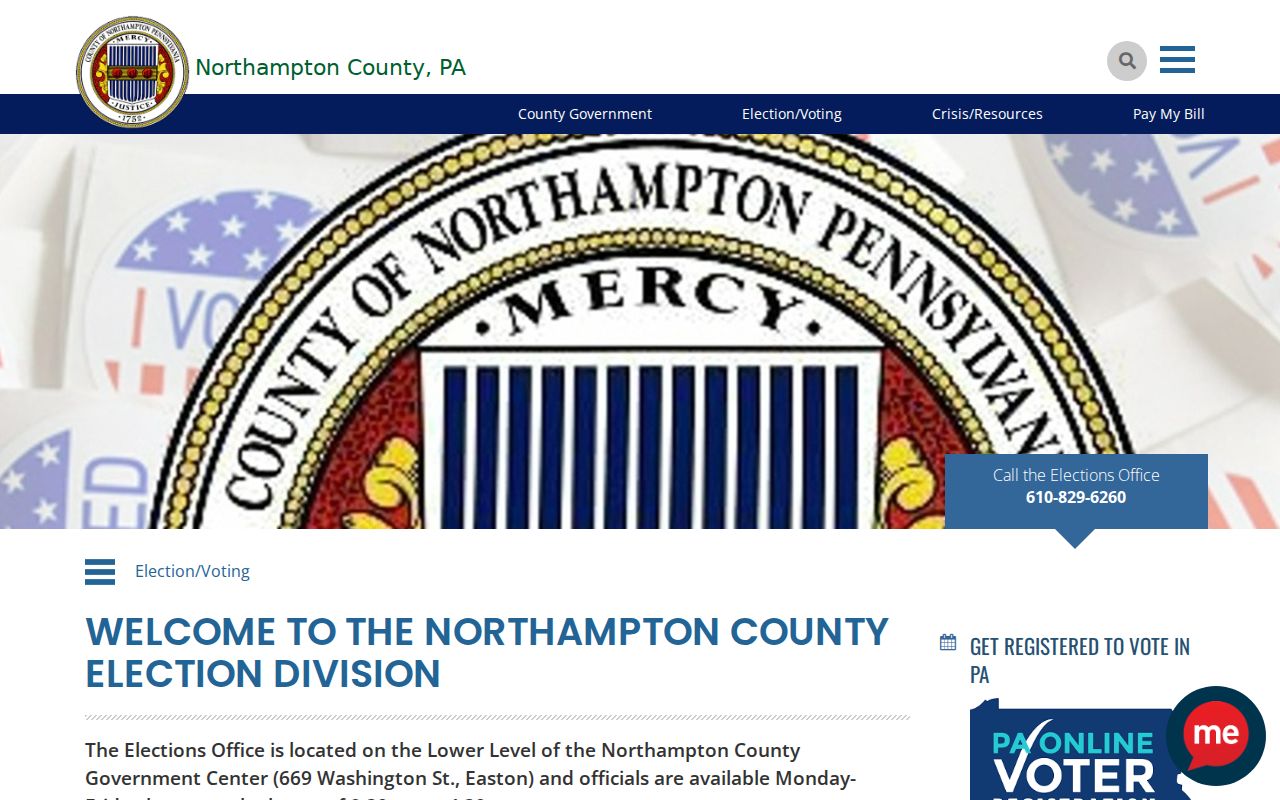
The office resource supports ballot and voter-service research, while the law keeps it from becoming a public block roster.
Bethlehem Township Record Geography
Older records require a place-name check before a block comparison. Bethlehem Township formed from Bucks County territory in 1746 and later lost territory to the Nazareth townships, Bethlehem borough, and Freemansburg. A historical record labeled Bethlehem Township can therefore concern a present-day different municipality. County GIS and a current parcel establish present geography. For older work, compare the road, cross streets, legal description, and neighboring parcels with BAPL maps, deeds, and the relevant historical record series.
This is a records-geography issue, not a reason to stretch an old name across modern boundaries. It becomes especially useful when researching a past household, an old development plan, or a deed that names a now-separate area.
Limits on Bethlehem Township Neighbor Searches
Property records, parcel maps, and deeds do not publish every renter, household member, utility customer, or delivery recipient. Pennsylvania's Address Confidentiality Program provides a substitute mailing address for eligible survivors. Driver and vehicle records are protected by the federal Driver's Privacy Protection Act. Court, voter, vital, and agency records can also have redactions, sealing rules, or statutory access limits. A missing result may reflect one of those rules, a different spelling, an offline series, or an ordinary record gap.
Official sources and commercial compilations answer different questions. A county parcel system identifies fields and its custodian. A commercial neighbor-lookup category may blend records of uncertain age, context, or identity. For a question that matters, verify the land record, election issue, or municipal file with its named office instead of treating a compiled result as proof.
| Official record route | Commercial compilation category |
|---|---|
| Names the custodian, field type, access conditions, and record date where available | May combine data without showing its source, timing, or correction path |
| Supports a narrow parcel, deed, permit, or election-administration question | Does not turn a historic or property match into proof of current residency |
| Allows correction questions to be directed to the responsible office | Cannot override a lawful public record held by a government custodian |
Lawful use. Use Bethlehem Township neighbor records for lawful personal research and civic context. Stalking, harassment, intimidation, and harm are prohibited under Pennsylvania law.