
Bethlehem Township Postal Coverage
The verified Bethlehem Township postal scope is deliberately narrow. Official Township and library facility pages establish 18020 as the core physical-address ZIP, with a Bethlehem postal label. Commonwealth public notices establish that some Bethlehem Township properties use 18045 with an Easton postal label. The available sources do not provide a definitive address-by-address Township inventory. For that reason, the table lists only the two postal relationships supported by the research rather than treating a postal area as a municipal boundary.
| ZIP Code | Areas Covered | Post Office | Notes |
|---|---|---|---|
| 18020 | Official Township facilities on Easton Avenue, Orth Street, Farmersville Road, and Falmer Drive, plus BAPL Coolidge | Bethlehem PA mailing label | Verified core physical Township ZIP. Use county address or parcel search for a specific property. |
| 18045 | Bethlehem Township properties identified in Commonwealth public notices | Easton PA mailing label | Verified Township-associated postal ZIP with a postal-label and municipality mismatch. Confirm with County GIS. |
Neither row means every address with that postal label lies in Bethlehem Township. The sources do not support adding 18015, 18017, a PO-box ZIP, or a larger Township ZIP inventory. The practical question is always address-specific: which ZIP does USPS assign, and which municipality does the county parcel system show?
Bethlehem Township Postal Labels
Postal routing and municipal identity answer different questions. A street address can carry the Bethlehem PA label while its parcel requires a separate municipal check. The same is true for a Bethlehem Township address with an Easton PA label. The 18045 evidence comes from Commonwealth public-notice records, not from a claim that postal lines follow the Township line.
USPS address lookup is the correct first check when a complete street address is available. Enter the address rather than relying on a town name, an old mailing label, or a nearby facility.
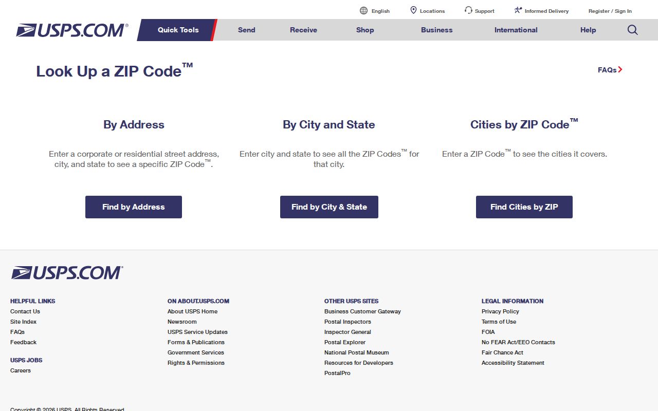
The USPS response verifies postal delivery information for the entered address. It does not replace the municipal location shown by a county parcel or GIS record.
Postal label versus municipality. A postal city is for mail delivery. The county GIS municipality field and parcel geometry resolve whether the property is in Bethlehem Township.
Verify a Bethlehem Township ZIP
The reliable postal workflow has four steps. First, confirm the full delivery address with USPS. Second, search the street address or parcel in Northampton County’s property system. Third, use the county GIS parcel geometry and municipality field to verify the local government area. Fourth, follow the deed reference or legal description through the Recorder if a land-record conclusion is needed. This sequence separates delivery routing, tax administration, mapped location, and recorded title.
- Use the USPS address-to-ZIP tool with the full street address, including any unit information needed for delivery.
- Search Northampton County Public Access by address or parcel and retain the parcel ID, property location, and deed reference.
- Check the parcel in the County GIS service for the municipality, parcel lines, address points, map, block, and lot context.
- Use the Recorder record if the address has an older description, a conflicting mailing address, or a question about the land itself.
The voter-status route is not a ZIP search. It verifies an individual’s registration and polling context as the state tool permits. Its documented purpose does not create a public list of residents for a ZIP.
Note: A ZIP value typed in a mailing-address field is correspondence information, not a geographic property-search result.
Bethlehem Township Parcel Search
Northampton County property data is the next step after postal confirmation because it can connect an address to a parcel record. The public landing page shows Address, Parcel, Sales, Advanced, and Map Search modes. The County tax-map guide documents typed location, owner, and map-block-lot routes, plus map-click, ruler, and print controls. It does not document a postal-code field. Treat the portal as a tool for finding a particular property reference, not as a ZIP-wide directory.
| Property field or mode | Type | Required | Documented use |
|---|---|---|---|
| Map | Text | With parcel mode | Enter the county map number, such as the guide’s J9 example |
| Block | Text | With parcel mode | Enter the block portion of the parcel description |
| Lot | Text | With parcel mode | Enter the lot portion and preserve punctuation as shown |
| Apply | Button | Parcel mode | Submits the map, block, and lot search |
| Property search location | Text | Location mode | Enter a street address, then select the correct parcel |
| Top-right address search | Text | Optional alternative | Alternate address route in the tax-map guide |
| Owner | Text | Owner mode | Checks a particular assessment owner, not a ZIP area |
| Map click or right-click | Map control | Optional | Displays parcel information at a chosen location |
| Ruler and Print | Map controls | Optional | Measures and produces a PDF tax map; neither establishes a legal boundary |
The related County land-records service exposes Parcels, Parcel Lines, Address Points, and Lot Dimensions. Its public schema is useful for confirming what may be in a parcel record, while the county still warns that assessment data can change or be deleted.
ZIP Filter Limits
There is no documented ZIP filter in the county property landing page or the Tax Parcel Viewer help. The public modes are address, parcel, sales, advanced, map, typed location, typed owner, and map-block-lot. The GIS service supports advanced spatial functions, but the public help documents location, owner, and parcel methods rather than a ZIP-wide results tool. A claim that the County portal can list every Bethlehem Township resident or property by ZIP would not be supported by the reviewed sources.
Once a ZIP has narrowed the area, switch from postal research to an address or parcel. The detailed by-address method belongs in the Bethlehem Township street directory. It starts with the specific street and parcel rather than trying to turn a delivery code into a property filter.
Bethlehem Township Address Roles
A parcel record has several address roles. LOCATION, or situs, identifies the taxable property’s location. The owner lines identify the assessment-side owner. Mail Address Lines 1 through 3 hold tax correspondence, which can be outside the Township or differ from the situs. A legal description, deed reference, map, block, lot, or subdivision reference connects the parcel to the recorded land record. These fields should stay separate in any postal search notes.
Map, block, and lot can outlast a changing house number. The Recorder’s recorded instrument and its prior-reference clause can bridge a modern property card to an earlier deed book or microfilm record. A tax mailing ZIP does not establish where a person lives, and a deed party does not establish present occupancy. The distinction is especially important when an address appears with a Bethlehem label in one record and an Easton label in another.
- Situs address
- The physical location of the taxable parcel in the assessment system.
- Mailing address
- The address supplied for tax correspondence, which may be different from the situs.
- Legal description
- The parcel’s recorded land description, such as a lot, subdivision, or map reference.
- Map, block, and lot
- County parcel-reference parts that help locate the same land when an address is incomplete or has changed.
Bethlehem Township Historic Boundaries
Older address research needs one more location check. Bethlehem Township formed from Bucks County territory in 1746 and originally included areas that later became Upper and Lower Nazareth Townships, Bethlehem, and Freemansburg. Separations occurred in 1780, 1807, 1845, and 1856. An old record labeled Bethlehem Township can therefore point to a place that is now in another municipality. That is a location-history issue, not evidence of a historic postal code.
The official Bethlehem Township general-information page is the source for the Township context shown in this image.
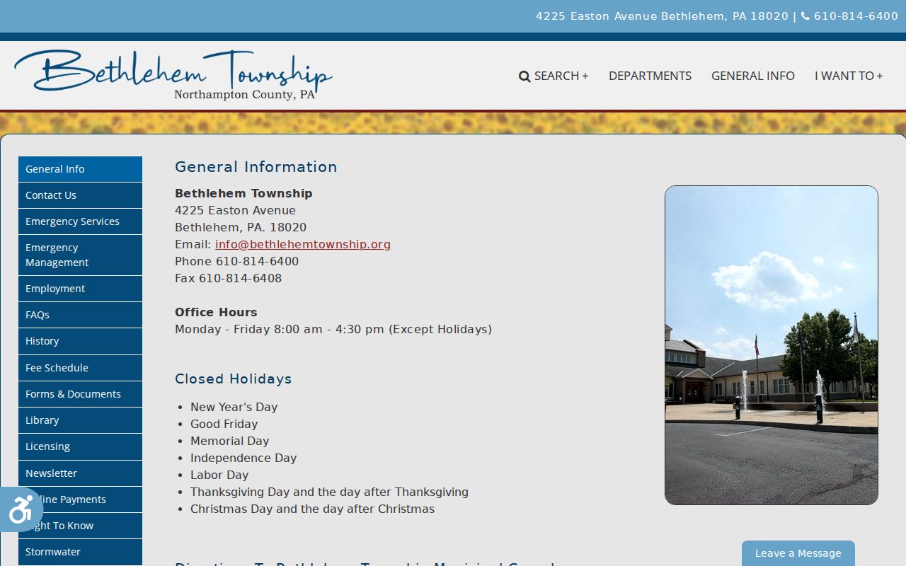
Use the Township’s current information alongside the official PennDOT Bethlehem Township map and County GIS when a road or parcel must be placed within today’s boundary.
Historical directories and deeds may use old street numbers as well. BAPL’s house-research guidance warns that a home can appear under different numbers across decades. A historic location needs its period map, street context, legal description, and neighboring entries, not a modern ZIP label.
Bethlehem Township ZIP Code Terms
Use these postal terms narrowly. They explain how USPS can organize delivery, but they do not prove a Township boundary or add unverified local ZIP service. The only physical Township ZIP relationships verified here are 18020 and the Township-associated 18045 examples. A full address lookup remains necessary before relying on any other ZIP claim.
- ZIP
- A postal routing code assigned to an address or delivery area. It is not a municipal-boundary map.
- ZIP+4
- An added four-digit delivery refinement used with a basic ZIP. Its local availability for any given address must be verified through USPS.
- PO-box ZIP
- A ZIP used for post-office boxes. No PO-box ZIP has been verified here as a physical Bethlehem Township street ZIP.
- Unique ZIP
- A ZIP assigned to a single organization or delivery destination. No unique ZIP is claimed for Bethlehem Township.
- Carrier route
- A postal delivery-route grouping. No local carrier-route availability or parcel-search feature is claimed from the reviewed sources.
Use the right locator. USPS verifies delivery routing, County GIS verifies a parcel’s municipality, and the Recorder verifies recorded land descriptions. Each source answers a different question.