
Bethlehem Township Previous Residents by Era
Previous residents of a Bethlehem Township address are found by moving from the current parcel record into older document and household sources. The record trail has different strengths in different periods. County assessment data anchors the modern parcel. The Recorder follows recorded ownership and land descriptions. BAPL directories and newspapers add names tied to historical addresses. Census, probate, tax assessments, and maps help test the gaps. None of these sources is a complete list of everyone who ever lived at one place.
| Source | Years It Covers | Where Held | What It Shows |
|---|---|---|---|
| Modern property and GIS roll | Current live data; historic start not published | Northampton County property site and GIS | Parcel, situs, owner and mailing fields, sale and deed references |
| Recorder counter chain | Remote cutoff not published; deeds 1752–1866 and grantor/grantee indexes 1752–1926 listed in the State guide | Recorder, Archives Landex, deed books, and State Archives series | Recorded ownership and legal-description trail |
| Historical tax assessments | Late 1700s through 1882 | Northampton County Archives | Assessed names and property context |
| BAPL directories | 1900/1901 onward; selected 1900–01, 1904, 1906, 1911, and 1917–18 verified | Bethlehem Room | Names, addresses, occupations, and nearby entries |
| Sanborn maps | 1885, 1892, 1897, 1904, 1912, and modified 1912 | BAPL microfilm and Bethlehem Room | Building footprint, use, and street-number context |
| Federal census | Released schedules through 1950 | National Archives and library genealogy services | Dated household snapshot by historic address or enumeration district |
| Orphans’ Court and probate | Estate series from 1752; dockets 1752–1866 and indices 1752–1882 in the State guide | Register/Orphans’ Court, State Archives, and County Archives | Estate, heir, fiduciary, and property-reference clues |
| BAPL obituary index | Incomplete; indexed years vary | BAPL index and microfilm | Death, marriage, and biographical citations |
Start with the current property record when the address is known. Start with a dated directory, map, obituary citation, or historical assessment when the question belongs to an earlier era. The most reliable result is a chain of sources that agrees on the parcel, the street context, or the people named in a recorded transfer.
Bethlehem Township Parcels Before the Past
A present-day address is only the beginning of a past-residents search. At the Northampton County property site or Tax Parcel Viewer, capture the parcel ID or CAMA ID, current LOCATION or situs, deed reference, map, block, lot, sale information, and legal or subdivision description. The county’s GIS schema also has owner lines and three mailing-address lines. Those are assessment-side fields: a mailing address can differ from the parcel situs, and neither field establishes every person who lived at the location.
| Parcel ID or CAMA ID | The county’s enduring identifier for the assessment and map record. |
|---|---|
| Current situs | The GIS LOCATION field, meaning the taxable parcel’s physical location. |
| Deed reference | A bridge from the assessment record to the Recorder’s instrument or book-and-page trail. |
| Map, block, and lot | Land-reference fields that can survive a changed street number or later subdivision. |
| Legal description | The recorded lot, plan, subdivision, metes-and-bounds, or prior-reference language that identifies the land. |
Use the property system as a locator, not a promise that the displayed data is complete or current. Northampton County calls its public property data a demonstration and disclaims accuracy and currency. The parcel’s legal description, lot reference, and recorded deed are usually better historical anchors than a modern number alone.
Bethlehem Township Previous Residents at the Recorder
Ownership is not occupancy, yet the deed chain gives the address trail its backbone. The BAPL house-research guide provides a Northampton-specific counter method. First obtain the parcel ID from the county property records. At the Northampton County Courthouse computer, enter that ID in the lower-left field and use F12/Retrieve Next. Highlight the deed, use F12 again, and read the deed or its left-side reference information for the prior book and page.
- Record the current parcel ID, current deed reference, legal description, map, block, lot, and situs address.
- At the Recorder counter, enter the parcel ID and use F12/Retrieve Next to locate the deed sequence.
- Highlight the deed and press F12 to read the document and identify its preceding book/page reference.
- Use F4 to return to the main screen, enter the older book and page, and repeat the sequence.
- At each transfer, preserve the named grantor, grantee, instrument or book/page, date, and land description before moving backward.
- Grantor and grantee
- The grantor conveys an interest in land; the grantee receives it. Follow the named roles in the document, not an assumed address-only sequence.
- Chain of title
- The backward succession of recorded transfers for the same land, connected by prior-reference language, parties, and land descriptions.
- Criss-cross directory
- A street-and-number arrangement that can help identify historical address context, if the specific BAPL volume actually includes one.
- Enumeration district
- The Census Bureau’s geographic unit for a decennial schedule, useful when a historic address must be located in census research.
Bethlehem Township Deed Chain at the Counter
The computer sequence eventually can stop recognizing a book and page. That is not the end of the deed trail. BAPL directs a researcher then to hard-copy deed books, with microfilm also used for older deeds. Northampton County says every recorded instrument is microfilmed and publicly inspectable. Its Archives also confirms that Landex is available at both the Recorder office and the Archives, giving Bethlehem Township research two local counter routes before the older book path begins.
No current official source reviewed publishes one remote online index or image cutoff year for Northampton Recorder records. Do not turn a web-search gap into a date of lost records. Ask the Recorder about current remote coverage, then use the counter, books, microfilm, and relevant Pennsylvania State Archives finding aid. County Archives offers free in-person research, $5 per-name mail or email research, and $0.50-page copies for its historical work. Some microfilmed records remain available only at the originating courthouse office.
Bethlehem Township Past Residents in Directories
Past residents are the household layer that deeds cannot supply on their own. BAPL directories begin at 1900/1901 in the verified material, with specific 1900–01, 1904, 1906, 1911, and 1917–18 volumes named in the house guide. They can connect a surname with an address, an occupation or business clue, and nearby names. Coverage must be checked street by street, and no official source reviewed verifies a fully dated criss-cross directory run for the Township itself. The historical volumes are described in more depth on the Bethlehem Township city directory page.
Pair a directory year with a released census instead of treating either source as final. The 1950 Census is the newest released decennial census in the research, under the Census Bureau’s 72-year release pattern. A directory can point to a street and a census can show a dated household snapshot, but each must be reconciled with the historical number, adjacent entries, and the parcel or deed description.
- Choose a verified BAPL directory near the period and record its title, year, page, spelling, address, and neighbors.
- Compare the entry with the current parcel’s legal description and the deed parties for the relevant transfer.
- Locate the historical address in the appropriate released census and enumeration district.
- Check the next available directory edition for a move, a renamed street, a changed number, or an omitted entry.
- Test the resulting timeline against maps, historical tax assessments, obituaries, and probate material.
Bethlehem Township Previous Residents on Maps
Sanborn maps do not name previous residents, but they can date and describe the structure attached to an old address. BAPL lists 1885, 1892, 1897, 1904, and 1912, including a modified 1912 edition, for Bethlehem map research. The sheets may show a building’s outline, material, use, street name, number, and boundary context. BAPL holds the maps on microfilm, and the 1892 original is in the Bethlehem Room.
A map’s silence has a limit. A blank block can be outside the sheet’s coverage, and building evidence cannot prove a household. Use a map to reconcile a street number or building change, then test the result with the deed chain, a selected directory, adjacent entries, and the released census. For an older Township reference, also account for the Township’s historic boundary changes before assigning it to today’s municipality.
Bethlehem Township Addresses With New Numbers
One of the clearest local warnings comes from BAPL’s house guide: a home may appear as 24, then 121, then 421 over several decades. The example does not establish a Township-wide renumbering policy. It shows why a historical address search must preserve the street name as printed, cross streets, neighboring names, parcel reference, and the deed’s land description. The 1900–1901 Lehigh directory project also notes early city street-name changes, a regional clue that should not be projected onto every Township road.
When numbers no longer align, compare both addresses on the appropriate directory page and map sheet. Nearby households can show continuity, while map/block/lot and legal-description fields can bridge the old address to the current parcel. Historic place names need the same caution: Bethlehem Township once included land that is now in other municipalities, so the location named in an older source may not fit current boundaries.
Bethlehem Township Previous Residents and Estate Clues
Probate and obituary material can close a trail, but they should confirm rather than fill in a guess. Northampton County’s Register of Wills and Orphans’ Court holds decedents’ estate records from 1752 forward. The State Archives guide identifies related Orphans’ Court dockets from 1752–1866 and indexes from 1752–1882. These records can identify an estate, fiduciary, heir context, or property reference, while restricted adoption and juvenile material must not be assumed open.
The BAPL obituary and biographical index is an incomplete name-and-citation tool for local newspaper material.
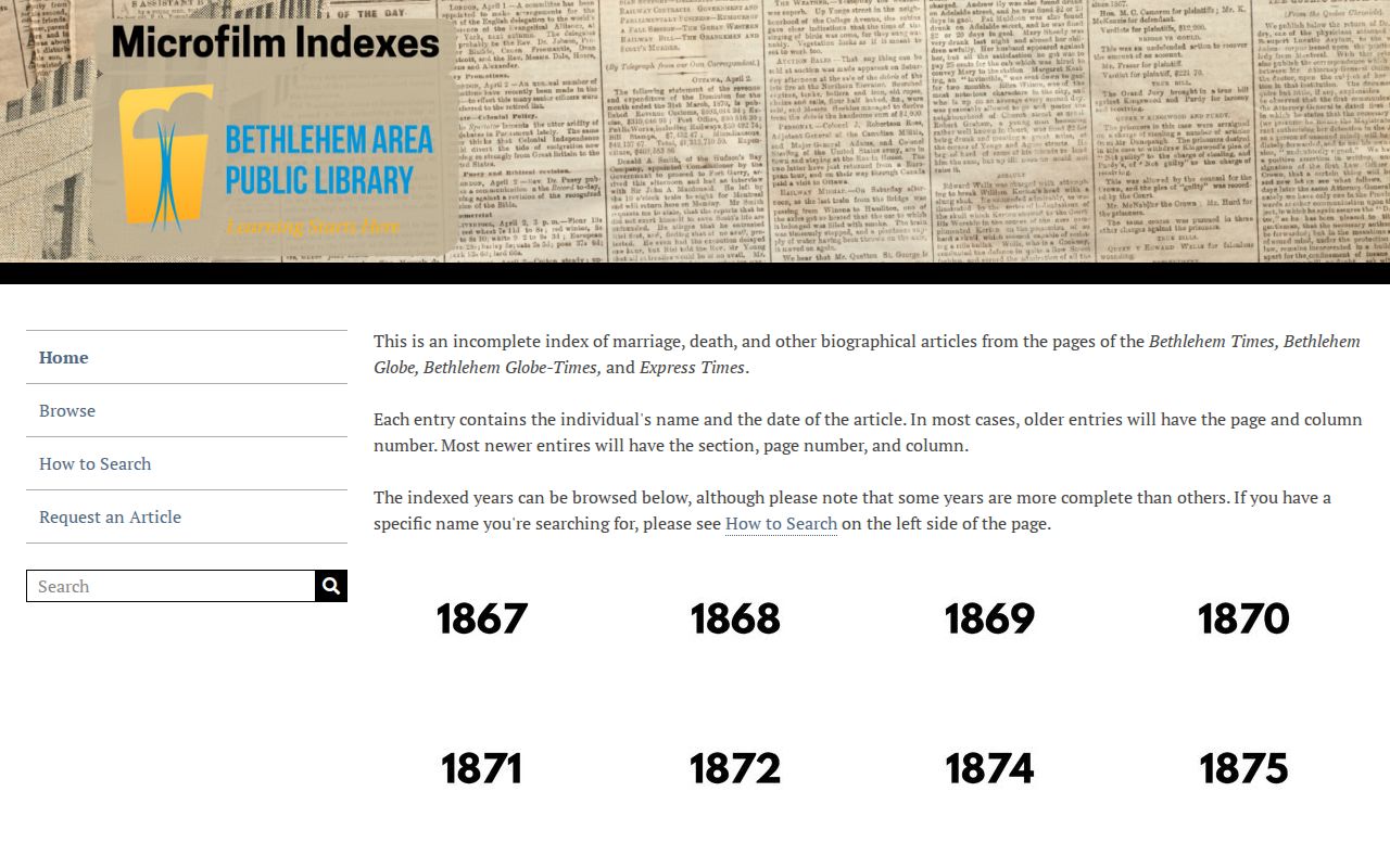
An index result can lead to BAPL microfilm or a staff request for the article or obituary. Compare the date and names in that material with the address trail, estate docket, map, and directory entry. This protects against attaching a common surname to the wrong household.
Lawful personal use. Use Bethlehem Township previous-resident research for family history, estate work, house history, or personal curiosity, and respect redactions, sealed records, and address-confidentiality protections. Never use a historical trail to harass or track a living person.